


Flood information for the Loddon Shire Council, encompassing local flood guides and a Municipal Flood Emergency Plan.
Loddon Shire Council Flood History
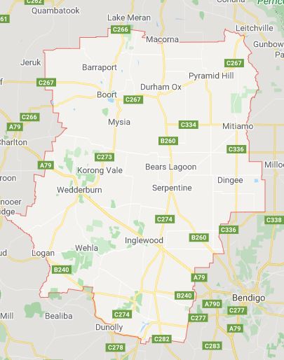
The Loddon Shire is located on a flood plain and is therefore subject to flooding from time to time, while engineering strategies have been implemented within some towns to reduce the impact of flooding.
Flooding throughout the Loddon river district ischaracterised by large expanses of slow moving water, and due to the extremely flat terrain even minor flooding can inundate areas within the region.
Bridgewater Local Flood Guide
Newbridge Local Flood Guide
Serpentine Local Flood Guide
Loddon Shire Council Flood and Storm Emergency Plan
Municipalities can use Municipal Flood and Storm Emergency Plans to prepare, respond and recover from flood and storm events.
Click the button below to view the Municipal Flood and Strom Emergency Plan.
About Flood Guides
Communities can use local flood guides to identify and better understand their local flood risk. They include information about: flood history, how to prepare & respond to floods and who to contact.
Contact Information


Local SES Units
- Wedderburn VICSES Unit:
Lot 2 Nardoo Court
Wedderburn, 3518