Mornington Peninsula Shire

Flood information for the Mornington Peninsula Shire, encompassing local flood guides and Municipal Flood Emergency Plan.

On this page:


Mornington peninsula municipal map
  Mornington Peninsula Shire municipal map.

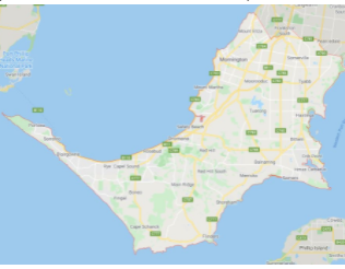
The Municipality consists of a high number of small catchments which drain into Port Phillip Bay, Western Port Bay or Bass Strait.

The catchments are generally characterised by rural or undeveloped areas in the upper regions of the catchment with more urban areas along or near the coast.

The main waterway systems running through the Shire are the Merricks, Main, Balcombe, Dunns, Manton, Stony, Watson, Warringine, Drum Drum Alloc, Chinamans, Kackeraboite and Tanti Creeks.

The lead time to respond to a flood event may be limited. All households and businesses at risk of flooding should develop an emergency plan and beware of their flood risk.

Are you at risk of flood?

Dromana & Safety Beach flood map
  Click to enlarge.

Safety Beach is located on flat terrain with Dunns Creek, Sheepwash Creek and Bald Hill Creek being the major creeks across the area.

When any of the creeks bursts their banks, floodwaters are likely to spread out across local roadways and properties.

Being by the coast, Safety Beach and Dromana are susceptible to Port Phillip Bay tide levels with these possibly impacting on flood levels from Sheepwash Creek and Dunns Creek.

Storm surge levels from Port Phillip Bay are likely to see water levels increase within Martha Cove but stay within the channel. Nepean Highway is at risk of flooding at multiple points as it crosses Dunns Creek, Sheepwash Creek and Bald Hill Creek.

Other infrastructure at risk is an Aged Care Facility and Retirement Village on Country Club Drive, Don Bosco School Camp on Dromana Parade and also a number of Caravan Parks along Dromana Parade High intensity.

Short duration rainfall events can cause flash flooding in and around Safety Beach and Dromana, while prolonged rainfall events may see Dunns Creek flood.

The area sees moderate water movement as the flood moved from the hills inland to slow water movement as it reached the flatlands close to shore. Flooding as a result may last for a number of days where the terrain is flattest.

Are you at risk of flood?

Rosebud and McCrae flood map
  Click to enlarge.

Chinamans Creek and Murray Anderson Creek are the predominant watercourses in the area,
flowing from the inland hills around Arthurs Seat.

High intensity, short duration rainfall events can cause flash flooding in and around Rosebud, Rosebud West, McCrae and Boneo, while prolonged rainfall may see Chinamans Creek and Murray Anderson Creek flood.

The area sees a mixture of moderate and slow water movement as water moves from the foothills of Arthurs Seat to the flatlands around Boneo and Rosebud West.

As a result, flooding on the foothills will rise and fall fairly quickly while ponding may occur where terrain is flat and last for days.

While significant floods have occurred within Rosebud and McCrae, flooding typically occurs in the low-lying areas of McCrae; however, flash flooding can occur in other areas as a result of short bursts of heavy rain fall that cannot drain away quickly.

In addition, there is also a risk of flooding and isolation caused by drains overflowing. The following roads are subject to closure during flooding around Rosebud and McCrae:

  • Mornington Peninsula Freeway between Beverley Road Pedestrian Bridge and Jetty Road.

  • Point Nepean Road, Rosebud and McCrae between Jetty Road and Bartel Street.

Are you at risk of flood?


 Mornington flood map
  Click to enlarge.

Tanti Creek and Fishermans Creek are the main waterways that run through Mornington and into Mount Martha, each with its own associated drains.

Fishermans Creek flows north through established residential areas. It receives Pitt Street Drain at Nelson Street before discharging into Port Phillip Bay at Fishermans Beach in Mornington.

Tanti Creek begins at Tanti Creek Retarding Basin and flows northwest mainly through reserves in a residential environment. It receives flow from Tarana Street Drain at Mornington Railway Station and Yuilles Road Drain at Yuilles Road before discharging into Port Phillip at Mills Beach Carpark.

While significant floods have occurred within Mornington, they typically occur in the low-lying areas of Mornington as shown on the map. Flash flooding can occur in other areas as a result of short bursts of heavy rain fall that cannot drain away quickly.

In addition there is also a risk of flooding, and isolation caused by drains overflowing. Historic records show large floods happen every 10-20 years in the area, already there have been many minor floods in the area.

The map to the right shows the possible flooding in a 1% flood in Mornington. A 1% flood means there is a 1% chance of a flood this size occurring in any year. This map represents one of many possible flooding scenarios in Mornington.

Are you at risk of flood?

Mt Eliza flood map
  Click to enlarge.

Balcombe Creek is the main watercourse that runs through Mount Eliza, flowing directly to Port Phillip Bay. Flow from Devilbend Reservoir feeds into Balcombe Creek in Mount Martha.

High intensity, short duration rainfall events can cause flash flooding in and around Mount Eliza, while prolonged rainfall may see Balcombe Creek flood. The area sees moderate water movement due to the rolling terrain in the area.

Flooding as a result generally rises and falls fairly quickly, however some areas of inundation may last for days.

Kackeraboite Creek receives runoff from several tributaries (small creeks that flow into a larger creek) while flowing north across Mount Eliza. It crosses the Nepean Highway before following the City of Frankston/ Mornington Peninsula Shire border to discharge into Port Phillip Bay. No formal warning times are available for Mount Eliza. This is due to small catchment sizes in the area and the occurrence of flash flooding.

Rain gauges at Devilbend Reservoir and Arthurs Seat may provide some warning of expected flooding. While significant floods have occurred within Mount Eliza, floods typically occur in the low-lying areas of Mount Eliza. However flash flooding can occur in other areas as a result of heavy rain fall that cannot drain away quickly. There is also a risk of flooding, causing isolation that can be caused by drains overflowing.

The map to the right shows the probable flooding in a 1% flood in Mount Eliza. A 1% flood means there is a 1% chance of a flood this size occurring in any year. This map represents one of many possible flooding scenarios in Mount Eliza.

About Flood Guides

Communities can use local flood guides to identify and better understand their local flood risk. They include information about: flood history, how to prepare & respond to floods and who to contact.

Contact Information

For more information, contact the Central Regional Headquarters.
For information on flood warnings, see the VicEmergency website.
Visit the Mornington Peninsula Shire website.
Your local Catchment Mangement Authority: Melbourne Water.

Local VICSES Units

  • Sorrento VICSES Unit:
  • Factory 4c/204 Boneo Road, Rosebud
  •  
  • Hastings VICSES Unit: 
    2144 Frankston - Flinders Road, Hastings

Municipal Flood Emergency Plan (MFEP)

Municipalities can use Municipal Flood Emergency Plans to prepare, respond and recover from flood and storm events.  
Mornington Peninsula Storm and Flood Emergency Plan.