


Yarra City Council
Flood information for theYarra City Council, encompassing local flood guides and a Municipal Flood Emergency Plan.
Yarra City Council Flood History
Yarra City Council Council has a history of flooding (riverine and flash flooding). A significant recent flood event occurred in February 2011.
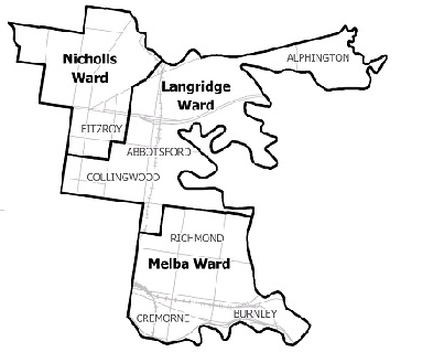
Locations at risk of flooding include:
- Alphington
- Abbotsford
- Richmond
- Burnley
- Cremorne
- Carlton North
- Fitzroy
- Fitzroy North
- Collingwood
Yarra City Council Local Flood Guide
At this time, there is no LFG for the Yarra City Council area. Go to the Plan and stay safe page for information on how you can plan and prepare for emergencies.
Yarra City Council Flood and Storm Emergency Plan
Municipalities can use Municipal Flood and Storm Emergency Plans to prepare, respond and recover from flood and storm events.
Click the button below to view the Municipal Flood and Strom Emergency Plan.
About Flood Guides
Communities can use local flood guides to identify and better understand their local flood risk. They include information about: flood history, how to prepare & respond to floods and who to contact.
Contact Information


Local SES Unit
- VICSES Heidelberg Unit:
- 446 Waterdale Road
Heidelberg Heights, Victoria - VICSES Malvern Unit:
- 293 Tooronga Road
Malvern, Victoria
Municipal Flood and Storm Plan
Yarra City Council Flood Emergency Plan - Updated September, 2023.