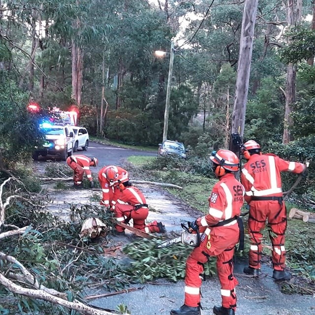
Preparation key as cold front approaches
The Bureau of Meteorology has confirmed that a cold front bringing vigorous north to northwesterly flows will result in damaging winds and heavy rain for parts of the State overnight on Tuesday into early Wednesday morning. Heavy Rain will also persist in the north east of the state on Thursday.
In what could be the most significant cold front of the winter, Victoria State Emergency Service (VICSES) volunteers are enhancing readiness arrangements to assist communities at risk.
We are asking Victorians to prepare now and remain vigilant particularly to the risk of damaging winds, which may cause trees and branches to fall and potential damage to homes and property.
Wind gusts up to 110km/hr are forecast to develop over elevated areas of the Central Highlands, Kinglake, Dandenong and Alpine Ranges. Elsewhere, wind gust of 90-100km/hr are possible. Locally destructive wind gusts with peak gusts of around 130 km/h are possible over Alpine peaks from early Wednesday morning
A Flood Watch is also in place for catchments in northeast Victoria, as rivers rise leading to potential of minor to moderate flooding from overnight Wednesday into Thursday across these catchments. Do not camp near the edge of rivers and streams and check the Vic Emergency App regularly for warnings.
The strongest winds are anticipated to occur in the early hours of Wednesday morning, and motorists need to be extra vigilant on the roads for debris including fallen tree. Consider your need to travel overnight in heavily treed areas of the State that are in those elevated areas whilst this weather passes given the significant risk of falling trees.
Now is the time to prepare. Residents should take the time today to check that loose outdoor items such as furniture, umbrellas and trampolines are safely secured well before the storm arrives. Ensure to park your vehicle/s undercover tonight, and away from trees.
Victorians should also ensure gutters, downpipes and drains are not blocked to cope with the potential of heavy rainfall.
Keep up to date with the latest warnings and advice messaging by downloading the VicEmergency app, and check the VicTraffic mobile app or website before travelling for updates on road closures, hazards and to consider alternate routes.
Call 132 500 for emergency assistance from VICSES, and please be patient if lines are busy during peak periods.
Quotes attributable to VICSES Chief Officer, Operations, Tim Wiebusch
“Our volunteers across the state are prepared to assist communities with the severe weather conditions forecast for overnight tonight. However with damaging to destructive winds possible, it’s vital you remain vigilant and up to date on the latest warnings and advice.”
“Ensure you listen to the advice of emergency services, and secure loose items in and around your home, park your vehicle undercover, away from trees and remain indoors until the severe weather has passed”.
“As we are expecting heavy rain in parts of Victoria, it’s important you never drive through floodwater. It does not take much for your car to become unstable, lose traction or wash away. Attempting to drive through flood waters may be the last decision you make.”
“Please keep up to date with relevant emergency information by visiting the VicEmergency website, or by downloading the VicEmergency app. And ensure to call 132 500 for any VICSES assistance required, and please be patient if lines are busy.”


