


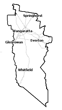
Flood information for the Rural City of Wangaratta, encompassing local flood guides and a Municipal Flood Emergency Plan.
Rural City of Wangaratta Flood History
Officially the 1993 flood is the highest, peaking at 12.98m on the Wangaratta Ovens River floodgauge. During this flood, the Ovens River, King River and 15 Mile Creek overflowed, flooding Wangaratta and costing the region $350 million when:
-
516 houses were affected by floodwater.
-
$962,000 damage was done to local roads, and bridges were either damaged or destroyed.
-
Water and sewerage infrastructure sustained damage.
-
Extensive crop and pump were damaged.
-
800 kilometres of rural fencing was destroyed.
-
Stock losses were experienced through the area.
-
Flooding of caravan parks occurred.
A flood peak in the King River generally happens before a flood peak in the Ovens River. This can give people advanced warning of anticipated flooding from the Ovens River before it occurs.
Wangaratta Local Flood Guide
About Flood Guides
Communities can use local flood guides to identify and better understand their local flood risk. They include information about: flood history, how to prepare & respond to floods and who to contact.
Contact Information


North East.
Local SES Units
- Wangaratta VICSES Unit:
36 Handley Street, Wangaratta
Municipal Flood and Storm Plan
Rural City Of Wangaratta Flood Emergency Plan