


Ararat Rural City Council History
Ararat Rural City has a history of flooding including a significant flood event in January 2011
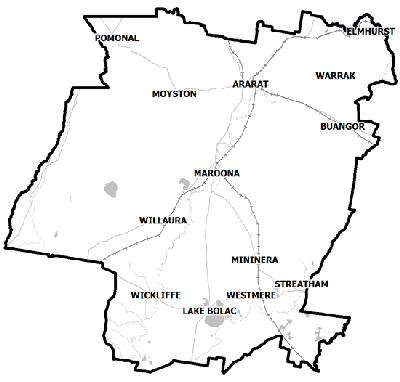
which impacted the township of Wickliffe and vast extents of rural areas resulting in extensive damage.
The January 2011 flood event is the largest event recorded at Wickliffe since 1920 when gauged records began. The 2011 floods occurred after four days of heavy rainfall on an already wet catchment.
During this flood:
-
It took approximately 24 hours for water to travel from the Ararat gauge to Wickliffe
-
Residents were evacuated
-
The Glenelg Highway was closed for two days
-
Eleven houses were inundated above floor level including the Wickliffe Hotel
Wickliffe Local Flood Guide
Click the button below to view the Local Flood Guide, which includes information about the local flood risk and how you can prepare for and respond effectively to floods.
Ararat Rural Flood and Storm Emergency Plan
Municipalities can use Municipal Flood and Storm Emergency Plans to prepare, respond and recover from flood and storm events.
Click the button below to view the Municipal Flood and Strom Emergency Plan.
About Flood Guides
Communities can use local flood guides to identify and better understand their local flood risk. They include information about: flood history, how to prepare & respond to floods and who to contact.
Contact Information


Glenelg Hopkins
Local SES Units
- Ararat VICSES Unit:
85 High Street,
Ararat, 3377