City of Port Phillip

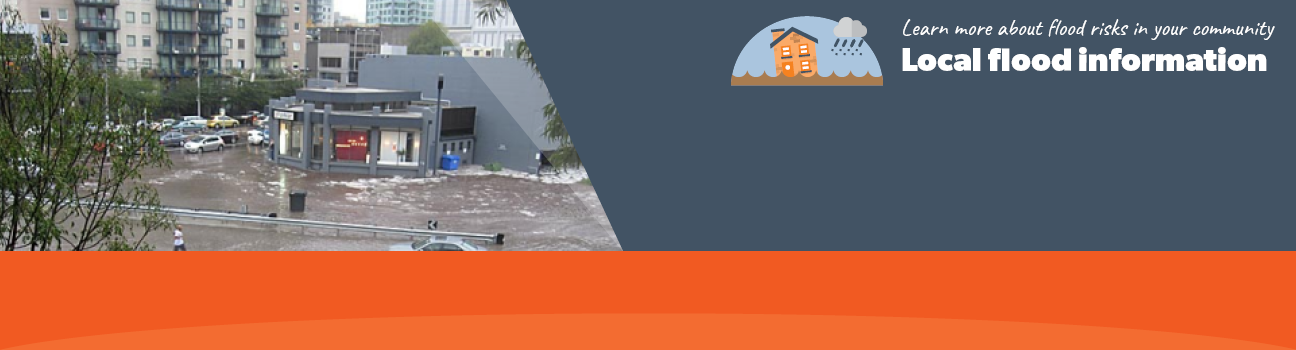
Flood information for the City of Port Phillip Council, encompassing local flood guides and a Municipal Flood Emergency Plan.

On this page:


City of port phillip municipal map
City of Port Phillip municipal map.

Large severe floods within the municipality generally occur as a result of a moist warm airflow from northern Australia bringing moderate to heavy rainfall over a period of 12 hours or more following a prolonged general rainfall.

The period of general rainfall 'wets up' the catchments potentially filling the on-stream dams and the natural flood plain storage. These combine to increase the run-off generated during the subsequent period of heavy rainfall.
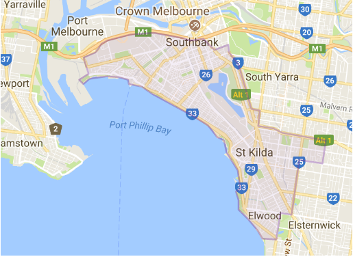
 

Are you at risk of flood?


Balaclava and St kilda flood map
  Click to enlarge.

Parts of Shakespeare Grove have open waterways or channels that are serviced by the Shakespeare Grove drainage network and can flood due to:

  • Heavy rainfall occurring over a short period of time, which overwhelms the drainage system and leads to flooding.

  • Prolonged rainfall events.


Flash flooding occurs because rain falls faster than the ground can absorb it, causing water to runoff into low-lying areas and local drainage systems, that are unable to cope with the volume of water.


This results in water rising rapidly and flowing powerfully and quickly. It occurs so fast that it is difficult to provide a detailed warning.

Storm surges and tidal flows from Port Phillip Bay may also have an impact on flooding as they may limit the ability of the drainage network to release the storm water into the bay.

Whilst floodwater in the St Kilda and Balaclava area is expected to rise fairly quickly, it will generally last only a number of hours before receding.

This map to the right is provided as a guide only to possible flooding along the Shakespeare Grove Main Drain area.

Are you at risk of flood?


South Melbourne flood map
Click to enlarge

Although there are no open waterways or channels running through South Melbourne, there are several main drains including the Hanna Street main drain running along Kings Way which is the most extensive.

Due to South Melbourne being an urban area, there isn’t a lot of green space to absorb rainfall. This results in water tending to run off towards lower lying areas.

During high intensity rain, usually occurring during thunderstorms, the level of rainfall can cause the drainage systems to exceed their capacity resulting in flash flooding.

Flash flooding occurs with little warning, only lasts a short time but can cause severe localised damage.

The following map to the right shows the expected flooding in a 1% flood in South Melbourne. A 1% flood means that there is a 1% chance of a flood this size occurring in any one year.

Are you at risk of flood?

Elwwod flood map
Click to enlarge.

Approximately 35% of the City of Port Phillip is three metres or less above sea level and the terrain is relatively flat.

The City of Port Phillip has experienced flooding issues that have included floods caused by high tides, pipe blockages and floods associated with intense rainfalls.

As the water within Elster Creek and the Elwood Canal can rise very rapidly, there is generally very limited opportunity for advance warnings to be issued to residents and business owners.

However the canal system is also unique as water levels can recede rapidly. Streets at risk of flooding in Elwood should be avoided if flooding occurs. 

The map to the right shows the impact of a 1% flood in the Elwood area. A 1% flood means there is a 1% chance of a flood up to this size happening in any given year. This map is provided as a guide to possible flooding within the area.

About Flood Guides

Communities can use local flood guides to identify and better understand their local flood risk. They include information about: flood history, how to prepare & respond to floods and who to contact.

Contact Information

For more information, contact the  Melbourne Metropolitan (Central) Region Headquarters.
For information on flood warnings, see the VicEmergency website.
Visit the City of Port Phillip website.
Your local Catchment Mangement Authority: Melbourne Water.

Local VICSES Unit

Port Phillip VICSES Unit:
525 Williamstown Road,
Port Melbourne.

Municipal Flood Emergency Plan (MFEP)

Municipalities can use Municipal Flood Emergency Plans to prepare, respond and recover from flood and storm events.
City of Port Phillip Flood  and  Emergency Plan - Updated Feb, 2019