


Flood information for the Colac Otway Shire, encompassing local flood guide and Municipal Flood Emergency Plan.
Colac Otway Flood History
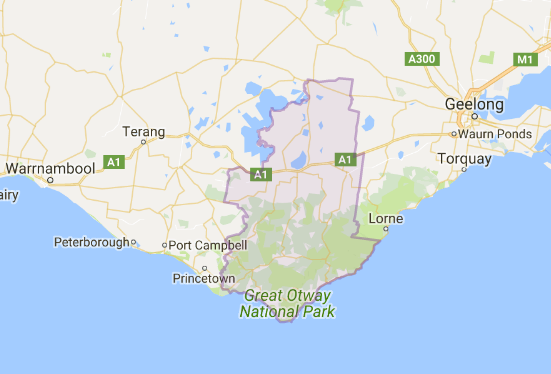
Parts of Colac Otway Shire can experience both riverine and flash flooding. The Barham River, flowing down from the Otway Ranges, cuts through the western side of Apollo Bay and, during prolonged rainfall, the river swells, forming a natural floodplain.
Flooding at Apollo Bay and the surrounding area can result in the closure of the Great Ocean Road because of the risks of landslides, which can isolate the town for days after a flood.
The lead time to respond to a flood event may be limited. All households and businesses at risk of flooding should develop an emergency plan and beware of their flood risk.
Apollo Bay Local Flood Guide
Click the button below to view the Local Flood Guide, which includes information about the local flood risk and how you can prepare for and respond effectively to floods.
Colac Otway Shire Flood and Storm Emergency Plan
Municipalities can use Municipal Flood and Storm Emergency Plans to prepare, respond and recover from flood and storm events.
Click the button below to view the Municipal Flood and Strom Emergency Plan.
About Flood Guides
Communities can use local flood guides to identify and better understand their local flood risk. They include information about: flood history, how to prepare & respond to floods and who to contact.
Contact Information


Local SES Units
- Colac VICSES Unit:
87 Wilson Street, - Colac, Victoria
- Otway VICSES Unit:
- 10 Lavers Hill-Cobden Rd,
- Beech Forest, Victoria