Horsham Rural City Council
Flood information for the Horsham Rural City Council, encompassing local flood guides and the Municipal Flood and Emergency Plan.
Horsham Flood History

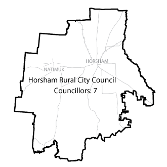
Horsham Rural City has a history of flooding, with significant flooding occurring more than 15 times since records began in the mid-18th century.
The January 2011 flood event is the largest event on record in Horsham, with the Horsham Gauge measuring 4.27 metres at Walmer. During this flood:
-
Horsham was split in two by floodwater
-
Two aged care facilities, one caravan park and other municipal facilities were evacuated
-
500 properties were isolated by floodwater
The lead time to respond to a flood event may be limited. All households and businesses at risk of flooding should develop an emergency plan and be aware of their flood risk. Households and business should refer to their Local Flood Guide or Horsham Rural City Flood Emergency Plan for more information.
Horsham Local Flood Guide
Are you at risk of flood?
Horsham has a history of flooding, with significant flooding occurring more than 15 times since records began in the mid-18th century.
The January 2011 flood is the largest in living memory. Many properties in southern and eastern Horsham are located on a floodplain that is prone to riverine flooding as well as flash flooding during periods of heavy rainfall. It can take up to four days for the peak of the flood to reach Horsham from the upper catchment. This does not mean you will not be affected by flooding prior to the peak arriving.
There are three river level gauge boards in Horsham, located on the river at Southbank, the Riverside Bridge, and on Burnt Creek at Williams Road. These boards provide river height information during a flood, and are used to monitor flood heights. Each flood gauge board has an information sign, allowing passers-by to view the historic peak flood levels at that site.
The map to the right shows an aerial view of the January 2011 flood - the largest on record measuring 4.27 metres at the Horsham Gauge at Walmer.
Natimuk Local Flood Guide
Are you at risk of flood?

After heavy rainfall, parts of Natimuk can flood within as little as seven hours from the Natimuk and Little Natimuk Creeks. The soil moisture levels prior to the rain and the duration and intensity of the rain can both increase or decrease flooding in Natimuk.
Areas of Natimuk that are prone to flooding are:
-
Station, Sudholz, Elmes and Jory Streets
-
Lake Avenue Wimmera Highway
-
Depot Lane
The map to the right shows properties in Natimuk that could be affected by a flood that is similar in size to that of January 2011.
Dadswells Bridge Local Flood Guide
Are you at risk of flood?
Mt William Creek drains the eastern ranges of the Grampians National Park and flows north from Mt William towards Dadswells Bridge. Flooding can take 1 to 3 days to arrive in Dadswells Bridge from the start of heavy rainfall in the upper Mt William catchment. Most of the floodwater from Mt William Creek flows into Lake Lonsdale.
During flood events Lake Lonsdale often spills into Mt William Creek, causing significant flood impacts downstream at Dadswells Bridge. Flooding may take 8 to 12 hours to arrive in Dadswells Bridge from spills in Lake Lonsdale. The size of the flood event at Dadswells Bridge is dependent on rainfall and level of Lake Lonsdale prior to a flood event. Current Lake Lonsdale levels can be found at the GWMWater website storagemanager.com.au/reservoir-levels-and-other-information/
About Flood Guides
Communities can use local flood guides to identify and better understand their local flood risk. They include information about: flood history, how to prepare & respond to floods and who to contact.
Contact Information
Local VICSES Unit
Horsham VICSES Unit:
54 McPherson Street
Horsham, Vic
Municipal Flood Emergency Plan (MFEP)
Horsham Rural City Flood and Storm Emergency Plan - Coming soon.