


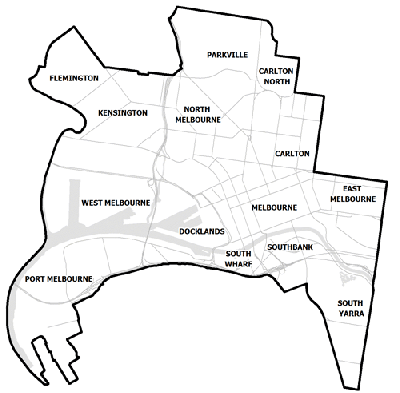
Flood information for the City of Melbourne, encompassing local flood guides and a Municipal Flood Emergency Plan.
City of Melbourne Flood History
City of Melbourne has a history of flooding (riverine flooding and flash flooding) including a significant flood event in November 2010 and February 2005.
Riverine flooding in February 2005 caused widespread disruption to transport infrastructure.
Flash flooding in November 2010 in the CBD caused significant property damage. Other significant flood events have occurred in 1891, 1906, 1916, 1924, 1934 and 1974.
Tidal flows from Port Phillip Bay may also influence flooding in some locations within City of Melbourne.
The lead time to respond to a flood event may be limited. All households and businesses at risk of flooding should develop an emergency plan and beware of their flood risk.
Households and business should refer to their Local Flood Guide or City of Melbourne Flood Emergency Plan for more information.
Melbourne CBD Local Flood Guide - Southbank
Click the button below to view the Local Flood Guide, which includes information about the local flood risk and how you can prepare for and respond effectively to floods.
Kensington, North Melbourne and West Melbourne Local Flood Guide
Click the button below to view the Local Flood Guide, which includes information about the local flood risk and how you can prepare for and respond effectively to floods.
City of Melbourne Flood and Storm Emergency Plan
Municipalities can use Municipal Flood and Storm Emergency Plans to prepare, respond and recover from flood and storm events.
Click the button below to view the Municipal Flood and Strom Emergency Plan.
About Flood Guides
Communities can use local flood guides to identify and better understand their local flood risk. They include information about: flood history, how to prepare & respond to floods and who to contact.
Contact Information


Local SES Units
-
Footscray VICSES Unit:
95 Sunshine Road,
West Footscray. -
Port Phillip VICSES Unit:
525 Williamstown Road,
Port Melbourne.
Municipal Flood and Storm Plan
Municipalities can use Municipal Flood and Storm Plans to prepare, respond and recover from flood and storm events. City of Melbourne Flood and Emergency Plan - Updated November 2021.
This municipal flood and storm management plan is currently being updated. The revised and updated plan will be available soon.