


Northern Grampians Shire Council Flood History
Northern Grampians Shire has a long history of flooding including a significant flood event in October 2022. This impacted the areas of Glenorchy, Great Western, Halls Gap, Marnoo, Navarre, and St Arnaud.
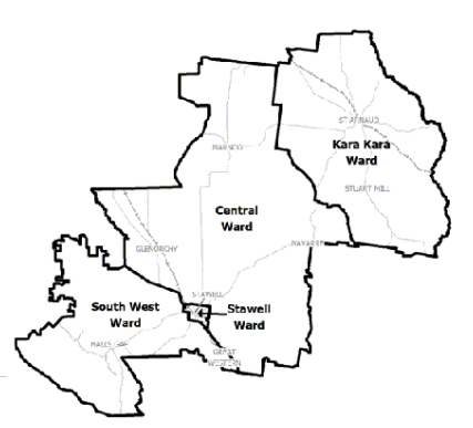
The key waterway which impacts Northern Grampians Shire Council is the Wimmera River.
The lead time to respond to a flood event may be limited. All households and businesses at risk of flooding should develop an emergency plan and be aware of their flood risk.
Households and businesses should refer to their Local Flood Guide or the Northern Grampians Shire Flood Emergency Plan for more information.
Halls Gap Local Flood Guide
Glenorchy Local Flood Guide
Northern Grampians Shire Council Flood and Storm Emergency Plan
Municipalities can use Municipal Flood and Storm Emergency Plans to prepare, respond and recover from flood and storm events.
Click the button below to view the Municipal Flood and Strom Emergency Plan.
About Flood Guides
Communities can use local flood guides to identify and better understand their local flood risk. They include information about: flood history, how to prepare & respond to floods and who to contact.
Contact Information


Wimmera.
Local SES Units
- St Arnaud VICSES Unit:
- 55 Wheeler St,
- St Arnaud, Victoria
- Stawell VICSES Unit:
33 Sloane Street, - Stawell, Victoria