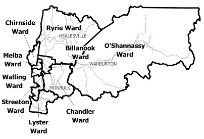
Yarra Ranges Shire Council
Flood information for the Yarra Ranges Shire Council, encompassing local flood guides and a Municipal Flood Emergency Plan.
Yarra Ranges Shire Council Flood History
Yarra Ranges Shire Council has a history of flooding (riverine and flash flooding) including significant recent flood events in February 2011, October 2010, September 2010 and February 2005.
Recent flood events have impacted the townships of Healesville, Yarra Glen and vast extents of rural areas resulting in extensive damage.
Healesville Local Flood Guide
Are you at risk of flood?
The main waterway running through the Yarra Ranges municipality is the Yarra River.
The Yarra River has several major branches including Don River, Watts River, Woori Yallock Creek, Stringybark Creek, Steels Creek, Dixons Creek and Little Yarra River.
Healesville sits on the Watts River where it’s joined by Grace Burn Creek and New Chum Creek. Flooding along the Yarra River and its branches can vary from fairly quick rises and falls, especially around the townships of Warburton and Healesville, to slow water movements with prolonged flooding around the nearby towns of Yarra Junction and Yarra Glen.
Heavy rainfall over a short period of time can cause flash flooding in and around Healesville, while prolonged rainfall over a number of days or weeks may cause the Watts River to overflow, affecting the centre parts of the town.
Flooding from the Watts River with flows from the Grace Burn Creek can cut off the northern, southern and eastern parts of Healesville from each other for short periods.
The table to the right highlights streets at risk of flooding in Healesville that should be avoided if flooding occurs.
Lilydale Local Flood Guide
Are you at risk of flood?
Lilydale Lake serves as a flood retarding basin for the area. Retarding basins are built to absorb and contain flooding in periods of high rain, helping to lower the chances of damaging flooding in the area.
While this helps reduce the likelihood of damaging flooding in the area, parts of Lilydale can still be affected when heavy rain falls over a short period of time, causing flash flooding. This can overwhelm the creek and drainage systems and spill over into the surrounding area.
Flash flooding can occur with little warming, lasts only a short time but can leave severe damage in the local area.
During flash flooding, parts of Lilydale may experience isolation for short periods as roads become inaccessible due to flood waters.
The map to the right shows the impact of a 1% flood in the Lilydale area. A 1% flood means there is a 1% chance a flood this size could happen in any given year.
Mooroolbark Local Flood Guide
Are you at risk of flood?
Brushy Creek is a relatively small waterway, which means that it can be quickly affected by heavy
rain leading it to rise and fall quickly. As the land in the Mooroolbark area is a combination of both hilly and flat areas, sudden intense rainfall can lead to episodes of flash flooding.
Flash flooding can occur with little warning, subside quickly but leave severe localised damage. Prolonged rainfall over a longer period of time can cause the Brushy Creek to overflow, leading to flooding.
During a flood, the following roads of Mooroolbark may be affected:
Community Infrastructure that may be affected in a flood includes:
- Brice Avenue Reserve Community Centre
- Mooroolbark Plaza Shopping Centre
- Manchester Preschool
- Esther Park and Soccer Grounds
- Barngeong Reserve
- Barngeong Reserve Kindergarten
- Lilydale Railway Train Line near Mooroolbark Railway Station.
Warburton Local Flood Guide
Are you at risk of flood?
When the area is in flood, East Warburton is most likely to be the first to be impacted by
floodwater in the area.
From here, the Yarra Fiver also flows right into the centre of Warburton, affecting areas surrounding the river.
The Warburton Caravan and Camping Park, located on the north bank of the river is at risk from flooding.
Major roads that may be subject to closure during flooding around Warburton and East Warburton include:
- Woods Point Road - closure of this road affects access to East Warburton, if flooding were to occur access could be cut for periods of up to 36 hours
- Acheron Way intersection
- Warburton Highway in Launching Place - whilst unlikely, if the flooding was severe enough, the Warburton Highway could be cut off affecting direct access to metropolitan Melbourne for a period of up to 72 hours.
The map to the right shows the expected flooding in a 1% flood in Warburton and East Warburton. A 1% flood means there is a 1% chance of a flood this size occurring in any year.
Yarra Glen Local Flood Guide
Are you at risk of flood?
The towns of Yarra Glen and Yering are located on a floodplain, which means that in a flooding event the water is expected to spread and will move slowly downstream towards the township of Warrandyte.
Flooding along the Yarra River can vary from fairly rapid rises and falls around Warburton and Healesville to slow water movement with prolonged flooding around Yarra Junction and Yarra Glen.
Roads that may be impacted by flooding of the Yarra River in Yarra Glen include:
- The Healesville-Yarra Glen road, between Bell Street and Yarra Valley Racecourse and between the Melba Highway and the Yarra Glen Bypass
- Armstrong Grove
- Bell Street
- Yarraview Road
The map to the right shows the expected flooding in a 1% flood in Yarra Glen. A 1% flood means that there is a 1% chance that a flood of this size could occur in any year.
Yarra Junction Local Flood Guide
Are you at risk of flood?
Yarra Junction is home to residential and rural properties, some of which lie on the floodplain.
The local Doon Reserve Caravan Park is also situated on the floodplain, meaning properties in this area are at risk from flooding.
Flooding in Yarra Junction can be caused by flooding from the Little Yarra River or the Yarra River and is most likely to affect low lying areas close to the river banks and in the floodplain between the two rivers.
Significant flows are possible that can contribute to larger flooding of the surrounding areas.
Flooding in the area has the potential to last several days, especially around areas along Settlement Road. Areas at risk in the event of flooding in Yarra Junction include:
- Doon Reserve Caravan Park
- Doon Road
- Lowes Road
- Settlement Road
- Corduroy Road.
The map to the right shows the impact of a 1% flood from either the Little Yarra River or the Yarra River in Yarra Junction. A 1% flood means there is a 1% chance of a flood this size occurring in any year.
About Flood Guides
Communities can use local flood guides to identify and better understand their local flood risk. They include information about: flood history, how to prepare & respond to floods and who to contact.
Contact Information
Local VICSES Units
- Emerald Unit:
- 277-287 Belgrave-Gembrook Road, Emerald.
- Lilydale Unit:
103 Nelson Street, - Lilydale.
- Healesville Unit:
Argoon Street, Healesville.
- Upper Yarra Unit:
2804 Warburton Highway,
Wesburn.
Municipal Flood Emergency Plan (MFEP)
Yarra Ranges Shire Council Flood Emergency Plan - Updated Oct, 2020.