Hepburn Shire Council

Flood information for the Hepburn Shire Council, encompassing local flood guides and the Municipal Flood and Emergency Plan.

On this page:


Hepburn municipal map
  Hepburn Shire municipal map.

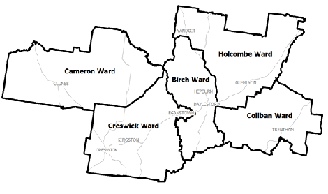
Hepburn Shire Council has a history of flooding including significant flood events in September 2010 and January 2011 which caused extensive damage to homes and businesses throughout the Shire.  The townships of Clunes and Creswick were hit the hardest.

The worst recorded floods in Creswick’s recent history are the September 2010 and January 2011 flood events, both classified as major flood events. These flood events occurred following heavy rainfall upstream of Creswick. In contrast the February 2011 event resulted from heavy, localised rainfall, particularly across Sawpit Gully. The January 2011 event caused:

  • Flooding of 90 homes and businesses

  • Flooding of the Castlemaine Road Bridge, restricting access to and from town via the Midland Highway

  • Flooding of the football oval and clubrooms, dental surgery, bowling club, part of a caravan park and the primary school

Are you at risk of flood?

Within the township of Clunes, there arenumerous homes, businesses andproperties at risk fromHepburn flood gaugefloods. Creswick Creek is prone to flash flooding which results from heavy rainfall over a short period of time overwhelming the creek’s capacity and causing it to overflow into parts of the township.

Clunes can also experience minor localised flash flooding from the smaller gullies and low-lying areas around the town. The earliest indicator of flooding in Clunes is when water breaks out of the creek moving west towards Purcell Street.

Records of 2010, 2011 and other historical floods show that low-lying areas including parts of Purcell Street, Fraser Street and the Clunes football oval and caravan park are prone to flooding following significant rainfall.

Clunes has a history of flooding, with significant floods occurring in 1869, 1870, 1871, 1893 and 1933. Clunes was impacted in both September 2010 and January 2011, and while the two events flooded a similar area, the January 2011 event was recorded at 6.39 metres on the Creswick Creek at Clunes gauge, approximately 300 - 400 millimetres higher than the September 2010 flood.

During the January 2011 flood, 200 millimetres of rain fell over four days, causing:

  • Drains along Service Street, Templeton Street, Fraser Street and Purcell Street to overtop

  • Flooding of the football oval and nearby properties

  • Flooding of low-lying properties near Camp Street and the site of the old Butter Factory at the start of Cameron Street

  • Floodwater breaking out of the creek bank at the caravan park, resulting in water flowing towards the BallaratMaryborough Road

  • Water to overtop Ligar Street, inundating the swimming pool, sports stadium and properties along the lower end of Fraser Street

  • Purcell Street creek side properties to be affected

  • The Service Street Bridge to overtop, inundating Service Street and part of the bowling club

  • Floodwater to extend to the southern side of Fraser Street between Templeton and Camp Streets, inundating commercial buildings

A river level gauge is located on Creswick Creek near Bailey Street. The table above provides an indication of what may be expected at different gauge heights. 

Are you at risk of flood?

Creswick is prone to flash flooding. FlashHepburn flood water gauge  flooding occurs because rain falls faster than the ground has the ability to absorb, causing water run-off into low-lying areas and local drainage systems. Local drainage systems are unable to cope with the volume of water causing the water to rise rapidly, flowing powerfully and quickly.

Flash flooding in Creswick has been frequent throughout the 1800s and 1900s, with significant floods reported mostly following a period of drought. Flash flooding occurs so quickly due to heavy rainfall that you may not receive an official warning.

It is important to be aware that no two flood events are the same and it is difficult to predict exactly the nature and extent of any future flood events. As a result, it can be difficult to predict when and where the next flood will be.

The table to the right shows measurements for the river level guage located on Creswick Creek near Bailey Street.

About Flood Guides

Communities can use local flood guides to identify and better understand their local flood risk. They include information about: flood history, how to prepare & respond to floods and who to contact.

Contact Information

For more information, contact the Mid West Region Headquarters.
For information on flood warnings, see the VicEmergency website.
Visit the Hepburn Shire Council website.
Your local Catchment Management Authority: North Central.

Local VICSES Unit

Hepburn Shire VICSES Unit:

Midland Highway,
Daylesford, VIC, 3460

Municipal Flood Emergency Plan (MFEP)

Municipalities can use Municipal Flood Emergency Plans to prepare, respond and recover from flood and storm events. Hepburn Shire Council  Flood  Emergency Plan - Updated June, 2020