


Local Flood Guides
Communities can use their Local Flood Guide to understand, prepare and respond effectively to their flood risk.
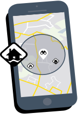
Find your Local Flood Guide
Check if your suburb has a Local Flood Guide by using the search function on the map below, or access an A-Z list of guides, sorted by suburbs and municipality.
No Local Flood Guide for your area? Go to the Plan and stay safe page for information on how you can plan and prepare for emergencies.
Local Flood Guides by Suburb A-Z
Local Flood Guide by Municipality A-Z
Local Flood Guide community consultation
The following Local Flood Guides are open for feedback from the community:
Local Flood Guide |
Consultation Period Ends: | |
|
|